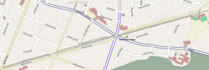
The E & N Rail Trail, boldly promised to be finished by “the 2010 Olympics” just a few years ago by the CRD (PDF), is now finally taking shape in Langford. I thought I would bike out there and see how it measured up.
For starters, this little section of the trail is tiny. Much like the Bowker Creek Greenway in Browning Park I talked about, network effects mean that both trails will get few users until such time as more of them are completed.
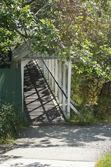
Starting for the westernmost side on Atkins Road, the trail starts with a very old pedestrian bridge over the trail, which was created for the students of Savory Elementary School. On the other side of the bridge you are dumped into the school yard about 50m from the actual start to the trail.
 ]
]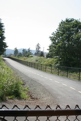
The trail itself is straight and fairly flat, although immediately the potential for conflicts with the adjacent parking lots became apparent. Why the CRD/City of Langford didn’t choose to at least bollard off this I don’t know. As it is, it is far too easy to drive onto not only this section of trail but also one other section west of Phipps Road.
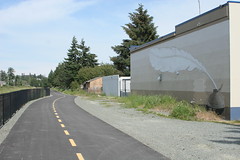
After crossing Veteran’s Memorial Parkway at Goldstream you wonder where the trail went. I really hope this is a temporary thing (there were construction signs everywhere along the trail stating it wasn’t open yet) because you can see just how bad it is.
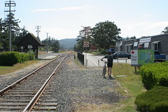
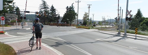
At the other end of this section, the section between the sidewalk and the trail is likewise unfinished. But that isn’t the worse part about the Peatt Road crossing. For some unknown reason, rather than just crossing in parallel with the rail line, you are forced to travel south to the intersection, cross Peatt there, then along the sidewalk, cross back over rail line (as of yet unfinished) and to the trail. Utterly ridiculous.
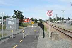
The other end of the trail (and current westernmost end) just dumps you out onto the sidewalk. No indication where you could go next for another trail, etc. I realize that the trail’s costs ballooned, but still. A simple sign directing you back to the Galloping Goose would have been nice. At least it has a connection to the road.
And thus we finish this section of the E&N Rail Trail. It is a great start but there are a few head-scratching decisions here and there. Hopefully these can be fixed but it is better to get it right the first time. Let’s hope the CRD and their member municipalities open up the design phase a bit earlier so that these mistakes can be caught and corrected before they are concrete (literally). To see larger versions of these pictures (and a few others) see my flickr set.